11″x14″ Reproduction from the hand colored engraving by Jacques N. Bellin. Displayed on corrugated board and sealed in a protective sleeve stamped with the cities crest.
Information sheet on back
11″x14″ Reproduction from the hand colored engraving by Jacques N. Bellin. Displayed on corrugated board and sealed in a protective sleeve stamped with the cities crest.
Information sheet on back
$10.00
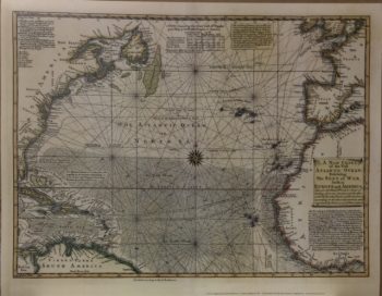
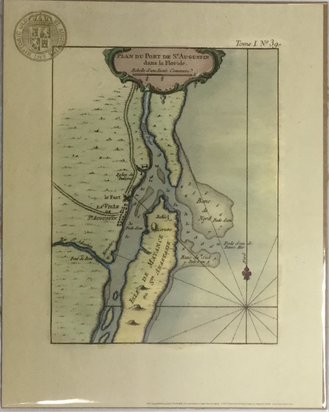
PLAN DU PORT de St. Augustin dans La Floride
This print is a reproduction of the hand-colored engraving by Jaques N. Bellin. It was first published by Le Petit Atlas Maritime, Paris in 1764. The original image size is 6 1/2 x 8 1/8 inches. The print size is 7 3/4 x 10 1/4 inches.
Jaques Nicolas Bellin was the Hydrographer to the King of France. From about 1650 to 1750, the French dominated the cartographic world with their fine, scientifically based maps elegantly engraved and precisely detailed. Bellin (1703-72) was one of the best in the later period. Bellin’s specialty was marine charts and this map of St. Augustine and its approaches is a good example of his output. The fortifications of St. Augustine are illustrated with useful information on the soundings in the entrance to the harbor. St. Augustine is the oldest, continuously occupied European city in the United States. Juan Menendez de Aviles established the first settlement nearly half a century before the first English settlers landed at Jamestown. St. Augustine grew to become the Spanish center of power in North America for almost 200 years. The British gained control of the city in 1763 at about the time of this map’s publication. Rhumb lines and a fleur-de-lis orient the map in the blank sea.
The original engraving, though quite small, included the basic layout of the town and its fort and the surroundings of the navigational entrance to the harbor. This is a fine eighteenth-century map of Florida.