11″x14″ Colored Map of Florida in 1850. Displayed on corrugated board and sealed in a protective sleeve.
Information sheet on back

$10.00
11″x14″ Colored Map of Florida in 1850. Displayed on corrugated board and sealed in a protective sleeve.
Information sheet on back
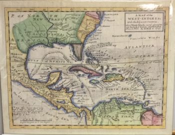
MAP OF FLORIDA 1850
Published by Thomas, Cowperthwait & Co. in Philadelphia in 1850. Original: 14.5 in. x 11.75 in
THOMAS COWPERTHWAIT published this map in his series of atlases in the 1850s entitled “Mitchells School Geography and Atlas.” The original cartographer’s name was concealed in this publication, though it retained the name of the publisher who produced it before Cowperthwait. The map’s origins came from Henry S. Tanner, a cartographer in the early 1800s who produced several series of maps depicting the United States. While Tanner’s version of the map is less detailed than that of Cowperthwait’s, it was used as the basis for Mitchell, Cowperthwait, and the later publishers of this map. Thomas Cowperthwait was a schoolbooks publisher in Philadelphia who purchased the copperplates of Tanner’s map from S. Augustus Mitchell in 1850 as Mitchell’s business was failing. Cowperthwait had Holmes County added to this map in the 1850 Atlas publication, updating the map to the current land divisions of Florida.
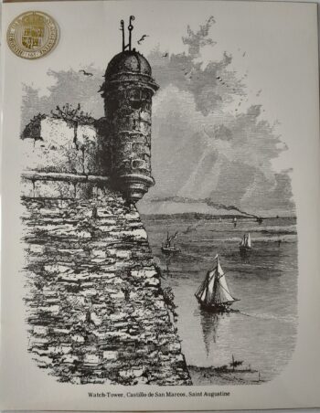
The insets of this map depict the cities of Tallahassee, Pensacola, and St. Augustine and provide interesting information about the cities’ layout, land possession, and places of historical significance. Lists of Water Routes are positioned on either side of the map with distances between cities. Each county is colored, showing divisions of Florida during that time period, 28 in total. Routes of the Army during the Seminole War, as well as Fortifications and Battle Grounds, are labeled accordingly throughout the state.
This map is significant because it was one of the first produced for both geographical and educational use. Its accuracy is exceptional, Mitchell’s cartographer, Mr. J. H. Young, was at the forefront of his field at this time, portraying accurate and informative data used by both professionals and students. This map is an excellent rendering of the state of Florida, presenting a view of the state prior to the Civil War and the development of the railroad system by Henry Flagler.